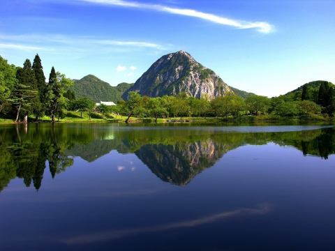
Takanami's pond and Mt Myojyo
Located at an altitude of 540m within Hakuba Mountain Foothills National Recreation Area, this plateau pond is 13m deep and holds a constant supply of water throughout the year.
This pond is a natural pond that is said to have been produced by a large landslide in the past. In this pond where abundant nature remains, witnessing of huge fish continues one after another, and it is familiar with nickname "Namitaro (Namitaro)" and "Midori".
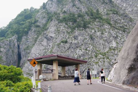
The rock wall of Mt Myojyo is captivated no matter how many times you look at it.
A lot of geological heritage that can be proud of in Japan and in the world ....
The rock wall of Mt Myojyo is a coral reef that has changed about 300 million years ago and contains many fossils. Beneath the large rock face, you can observe jade that has been washed by the clear waters of the Kotakigawa River.
·Approximately 30 minutes by car from our hotel.(National Route 148)
Superb view monopoly:★★★★★